
The Facts
What the record shows — and what it doesn't.
We separate documented project information from campaign analysis, label estimates clearly, and date everything.
Figures below are drawn from Provo City planning files, Council materials and meetings, and published reporting. Each is labeled Documented (stated in a public record), Estimate (applicant or reported figure, not final), or Not published (no public document available). Last reviewed September 3, 2026.
01
Traffic
How would large event traffic interact with a constrained corridor?
US-189 is the primary route through Provo Canyon. It carries commuters, recreational users, Sundance and Deer Creek traffic, freight, and emergency vehicles. The development agreement discussed by the Council would allow up to 20,000 seats and up to 8,000 parking spaces, with minimums for structured parking and a maximum acreage for surface parking. Applicant statements to media have described parking for roughly 7,000 vehicles, most of it underground. Those figures come from different sources and are not interchangeable.
- 20,000 Documented
- Maximum seats allowed under the development agreement discussed by the Council (about 8,000 indoor plus 12,000 outdoor, per applicant statements).
- 8,000 Documented
- Maximum parking spaces allowed under the development agreement as described in Council discussion.
- ~7,000 Estimate
- Parking spaces described by the applicant in media statements, most of them underground.
- 6,500 Documented
- Parking spaces described in the September 2026 community presentation — roughly 60 football fields of parking.
- 142 Documented
- Shows a year, mainly May–September, plus indoor events of 8,000–9,000 seats through the week and in winter.
- ~8,000 cars Estimate
- Estimated vehicles for a 20,000-person event — about 23 miles bumper-to-bumper — arriving 5:00–7:00 PM and departing 9:00–11:00 PM.
- 9,525 Documented
- Red Rocks Amphitheatre maximum seating for comparison: four main access points and two large highways, opened 1941, guests advised to arrive two hours early. Vesper proposes roughly double the capacity on a corridor with one highway.
- Not public Not published
- Peak-event vehicle trip generation and corridor level-of-service results for US-189.
Provo City Council materials and reporting, Aug 11, 2026
View sourceProvo City Council discussion, Aug 11, 2026
View sourceApplicant statements in news coverage
View sourceCommunity presentation on Vesper's proposal, September 2026 (campaign analysis)
Community presentation on Vesper's proposal, September 2026 (campaign analysis)
Community presentation on Vesper's proposal, September 2026 (campaign analysis)
Community presentation on Vesper's proposal, September 2026 (campaign analysis)
No standalone traffic analysis released for public review
View source02
Emergency access
Has emergency access been adequately modeled?
Fire response, ambulance transport, law enforcement access, and canyon evacuation all depend on the same roadway that would carry event arrivals and departures. Traffic and emergency access were among the concerns recorded at the June 1, 2026 North Timpview neighborhood meeting and repeated in public comment at the June 24 Planning Commission hearing. Modeling that includes peak event conditions has not been published.
- 1 Documented
- Primary highway corridor serving the site, canyon residents, recreation users, and emergency responders.
- Not public Not published
- Emergency response and canyon evacuation modeling under peak event load.
- Recorded Documented
- Traffic and emergency access concerns documented in the city's synopsis of resident concerns.
Site location, 6622 N Hwy 189 — Planning Commission staff report
View sourceNot present in released application materials
View sourceProvo City synopsis of resident concerns, June 1, 2026
View source03
Infrastructure
What would need to be built, and who pays?
The application covers roughly 100.7 acres at 6622 N Hwy 189: about 34.23 acres of an existing quarry owned by the Provo Canyon Mining Company and about 66.47 acres currently owned by Provo City. Reported plans describe roughly 40 acres of development — amphitheater, a 75-room hotel, restaurant, plaza, and parking. Access improvements, water, and wastewater capacity in a canyon are physically constrained; a complete infrastructure list with cost allocation has not been published.
- 100.7 Documented
- Acres in the General Plan and zone map amendment applications (PLGPA20260220).
- 66.47 Documented
- Acres within the application boundary currently owned by Provo City.
- 75 Documented
- Hotel rooms in the concept plan, alongside a restaurant and plaza.
- 150,000 sq ft Documented
- Retail described in the September 2026 community presentation — roughly the size of the Riverwoods shops — alongside hotel villas, restaurants and bars, and a bridge overpass.
- Not public Not published
- Utility, water, wastewater, and roadway improvement costs with public/private cost allocation.
Planning Commission staff report, June 24, 2026
View sourceReporting on Council rezone and proposed land purchase
View sourceApplicant concept plan reported in news coverage
View sourceCommunity presentation on Vesper's proposal, September 2026 (campaign analysis)
Not present in released materials
View source04
Land use
What does approval make permissible later?
The requests would move roughly 100.7 acres from Agricultural and Parks, Recreation, or Open Space designations to Commercial, and rezone the land to SC3 (Regional Shopping Center). Entitlements can outlive any single project, so what SC3 permits later matters as much as the amphitheater itself. On June 25, 2026 the Planning Commission voted not to recommend approval of the zone changes.
- SC3 Documented
- Requested zone: Regional Shopping Center, replacing Agricultural, Public Facilities and Open Space, Preservation, and Recreation zoning.
- Not recommended Documented
- Planning Commission recommendation to the City Council on the zone changes.
- 5–2 Documented
- Planning Commission vote to recommend denial of the proposed Vesper rezoning.
- 74.5 / 24.1 Documented
- Acres of public land and acres of private gravel pit in the footprint described in the September 2026 community presentation (100.7 acres total). City filings describe 66.47 city-owned acres and a 34.23-acre quarry — figures differ by source.
- 3 / 7 yrs Documented
- Development agreement terms discussed: construction must commence within three years and finish within seven. If deadlines are missed, the land could revert to Provo City.
- Vote first Documented
- Order of the current process as described in the community presentation: Council approval and zoning change ahead of finalized studies, rather than studies first.
Zone Map Amendment application, Planning Commission staff report
View sourcePlanning Commission action, June 25, 2026
View sourcePlanning Commission action, June 25, 2026
View sourceCommunity presentation on Vesper's proposal, September 2026 (campaign analysis)
Provo City Council discussion, Aug 11, 2026
View sourceCommunity presentation on Vesper's proposal, September 2026 (campaign analysis)
05
Noise and light
How do sound and light behave in a canyon?
Canyon walls reflect and carry sound farther than open terrain, and light and noise pollution were among the concerns residents raised in public comment at the Planning Commission hearing. Asked about noise at the June 24, 2026 Planning Commission meeting, Bryan Bayles of Vesper said the project would match the city's noise ordinance using state-of-the-art technology. No acoustic or lighting study for the site has been released for public review.
- 142 days Estimate
- Potential event days a year on which low-frequency bass could carry to Bridal Veil Falls and neighborhoods two or more miles away.
- Not public Not published
- Acoustic modeling, exterior lighting analysis, hours of operation, and a noise monitoring and mitigation plan.
- Recorded Documented
- Light and noise pollution raised in public comment at the June 24, 2026 hearing.
Community presentation on Vesper's proposal, September 2026 (campaign analysis)
Not present in released application materials
View sourcePlanning Commission public hearing coverage
View source06
Public land and public cost
What is the taxpayer exposure?
Because a majority of the application area is city-owned, the proposal has involved a discussion of Provo City selling land — reporting in July 2026 described a proposed purchase of about 75 acres alongside the rezone. Sale terms, road improvements, emergency staffing, and utility upgrades all carry public implications that should be public before a decision.
- ~75 Documented
- Acres of city land described in reporting as a proposed purchase tied to the rezone.
- Not public Not published
- Final land sale terms, appraisal, and any public cost or revenue projections.
KUER, July 20, 2026
View sourcePending; the amended application announced Sept 2, 2026 is not yet released
View source07
Canyon and conservation
What happens to the river, wildlife, and open space?
The site sits at the mouth of Provo Canyon along the Provo River corridor, which is both habitat and a water resource. Project organizers describe placing roughly 60.4 acres into a conservation easement, and the development agreement discussed by the Council would require a minimum easement acreage. The specific easement terms, boundaries, and holder have not been published.
- ~60.4 Estimate
- Acres organizers describe placing into a conservation easement, with roughly 40 acres developed.
- 34.23 Documented
- Acres of existing quarry within the project boundary, owned by the Provo Canyon Mining Company.
- Not public Not published
- Recorded easement terms, boundaries, easement holder, and river-corridor impact analysis.
Applicant statements; design described as not final
View sourceReporting on Council materials
View sourceNot present in released materials
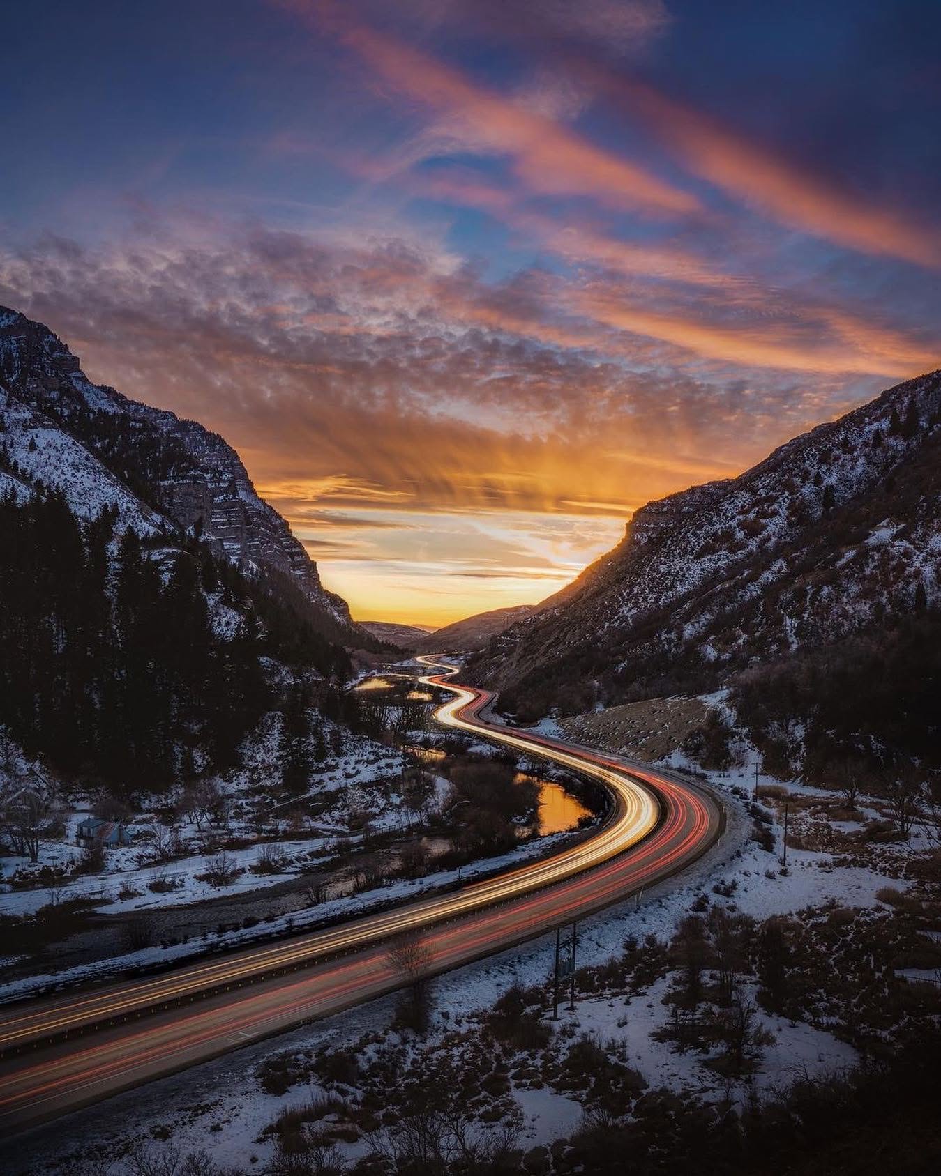
View sourceThe corridor, illustrated
An abstract representation of relative traffic conditions. Not a traffic model.
Commuters, residents, and recreational users moving through the canyon.
Abstract illustration. Vehicle counts are representative, not modeled figures.
Key figures
Drawn from Provo City planning and Council materials for application PLGPA20260220 and published reporting on the August 11, 2026 Council discussion.
0
Maximum seats allowed under the development agreement discussed by the Council.
Provo City Council materials, Aug 11, 2026
0
Maximum parking spaces allowed under the same development agreement.
Provo City Council discussion, Aug 11, 2026
100.7
Acres requested for redesignation to Commercial and rezone to SC3.
Planning Commission staff report, Jun 24, 2026
ONE
Primary canyon corridor — US-189 — serving residents, visitors, and responders.
Site location, 6622 N Hwy 189